

Month: August 2026
THE DIRT: Where Trails Meet Tranquility: New Campground Prioritizes Access and Experience
A new bicycle and pedestrian-friendly campground in Smelterville opened in May, offering visitors a unique, low-impact outdoor experience near the Trail of the Coeur d’Alenes. Located off Airport Road on the north side of Interstate 90, the campground includes 26 campsites, two of which are fully ADA-accessible. The accessible sites feature pathways connecting the trailhead parking area directly to the campsites.
Designed primarily as a bike-in or walk-in campground, the site encourages visitors to arrive without a vehicle. A 22-stall parking lot is available inside a gated area on a first-come, first-served basis. Not every campsite will accommodate a vehicle, and some visitors may need to park and walk up to 1,000 feet to reach their site. The campground road is approximately 10 feet wide with shoulders, but vehicle access beyond the gate is restricted to those with reservations.
Each campsite includes a bike rack and picnic table, while 11 sites also have hammock posts. The campground offers tent pads, a centrally located shower house with four stalls, flushable toilets, sinks, electrical outlets, and power for charging devices. Two e-bike charging stations are available—one near the shower house and another at the campground entrance. Visitors must bring their own chargers.
The campground supports Class 1 and Class 2 e-bikes, but not Class 3 e-bikes. The trail speed limit is 15 mph. ADA users may request an OPDMD permit through Idaho Parks and Recreation to use qualifying mobility devices. Dogs are welcome but must remain leashed, and owners are required to clean up after them.
The campground is located in an area that has undergone extensive environmental cleanup. Visitors should remain on designated paved and gravel surfaces because surrounding areas have not been fully remediated. In particular, soils in areas below the high-water mark may still contain elevated levels of heavy metals. Avoid disturbing these soils and follow posted signs and access restrictions.
Just east of the campground, cleanup at East Smelterville Flats has also transformed a former contaminated site into a safer recreational area. Phase 2 of the cleanup was completed this summer. The work included installing a new 12-inch clean soil cap, revegetating the 14-acre site, adding gravel walking paths, and installing four concrete pads for future picnic areas. Interpretive signage will help visitors understand both the area’s history and the environmental cleanup that has taken place.
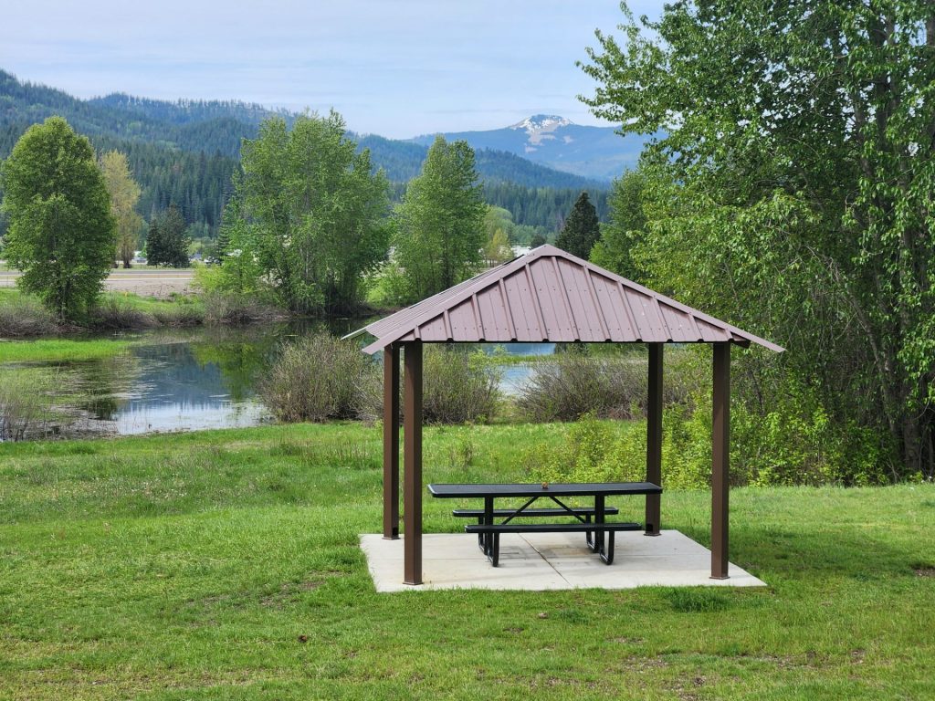
A new shade structure and picnic table, installed by the Kootenai Realtors Association just west of the Airport Riverwalk parking lot, provide another place for visitors to rest and enjoy the area. This fall, additional interpretive signs covering local history and environmental cleanup efforts will be installed.
Future plans include a trail connection between the campground and the Pinehurst Trailhead, pending agreements and funding.
Together, these projects demonstrate how cleanup and recreation can work hand in hand—protecting people from historical contamination while creating new opportunities to bike, walk, camp, and learn about the ongoing restoration of the Silver Valley.
THE DIRT: Part 2: From Tailings Pond to Engineered Repository—The Story Behind Page
At first glance, the Page Repository seems like an unusual place for an environmental cleanup project. Why would engineers build a repository in what appears to be a wetland?
The answer begins more than a century ago.
Long before the repository existed, the site served as the Page Mine tailings pond, where fine mining waste was deposited for decades. Those tailings contained elevated concentrations of lead and other metals, creating a long-term source of contamination.
When mining operations ended, the exposed tailings presented another problem. As they dried, fine contaminated particles became airborne, creating dust that posed a risk to nearby communities.
To prevent that from happening, cleanup managers intentionally maintained water over much of the former tailings pond. A water-control structure, known as a weir, was installed on the west end of the Page Swamp to maintain a relatively constant water level. During wet periods, the tiered weir allows excess water to flow downstream. During dry periods, it retains water over the tailings, preventing them from drying out and becoming mobile through wind erosion.
Over time, vegetation became established, wildlife colonized the area, and portions of the former industrial site developed wetland characteristics. Although these wetlands resulted from historic mining activities and subsequent cleanup actions—not natural processes—they became regulated under the Clean Water Act.
As engineers planned each repository expansion, wetland impacts were carefully evaluated through formal wetland delineations documented in the design reports. Federal law required those impacts to be compensated through wetland mitigation. Projects such as the West End Natural Infrastructure (WENI) project and later restoration work at Robinson Creek created and enhanced wetlands that replaced lost wetland functions while supporting the continued cleanup of contaminated mine waste.
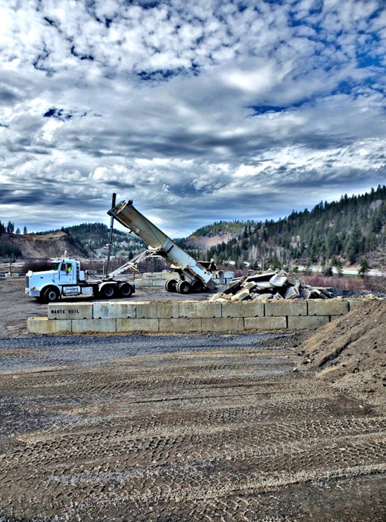
The concrete foundation visible today is another part of that long-term engineering strategy. The repository design calls for concrete or quarry rock beneath the disposal area to create a stable platform above the saturated ground. This foundation supports heavy equipment, minimizes settlement, and helps isolate contaminated materials from groundwater.
Stormwater management is a critical component of protecting water quality at the Page Repository. The repository is engineered with a tightly compacted surface that minimizes the amount of stormwater that comes into contact with the waste material. Surface runoff is directed to drywells, which convey the water into the engineered foundation beneath the repository. This design reduces the time stormwater is in contact with the waste while preventing erosion and uncontrolled runoff. Best management practices are also used to capture and remove sediment from stormwater before it enters the drywells, where it joins the water managed within the foundation system.
To verify that these engineering controls are working as intended, scientists monitor water quality at 14 locations around the Page Repository, including eight groundwater monitoring wells and six surface water sampling sites. Water samples are collected twice each year during both high-flow and low-flow conditions and analyzed for metals as well as key water quality indicators such as dissolved oxygen, pH, conductivity, and oxidation-reduction potential.
Once the engineered foundation is complete, contaminated soils are placed in controlled lifts over many years. The repository ultimately will reach approximately 60 feet of engineered fill before reaching its design capacity. Throughout construction, engineers carefully limit how much material is placed each season to maintain stability and allow the underlying foundation to settle as designed.
When repository operations are complete, the contaminated materials will be covered with an engineered cap that minimizes rain and snowmelt infiltration. Reducing the amount of water that moves through contaminated waste is one of the most effective ways to limit the movement of dissolved metals into groundwater and nearby streams.
The Page Repository represents decades of careful engineering and environmental planning. What may appear to be a pile of concrete is actually a critical component of an engineered system designed to safely contain contaminated mine waste, protect water quality, and support the continued cleanup of the Coeur d’Alene Basin for years to come.