

Month: October 2026
THE DIRT: What are bollard and what do they do?
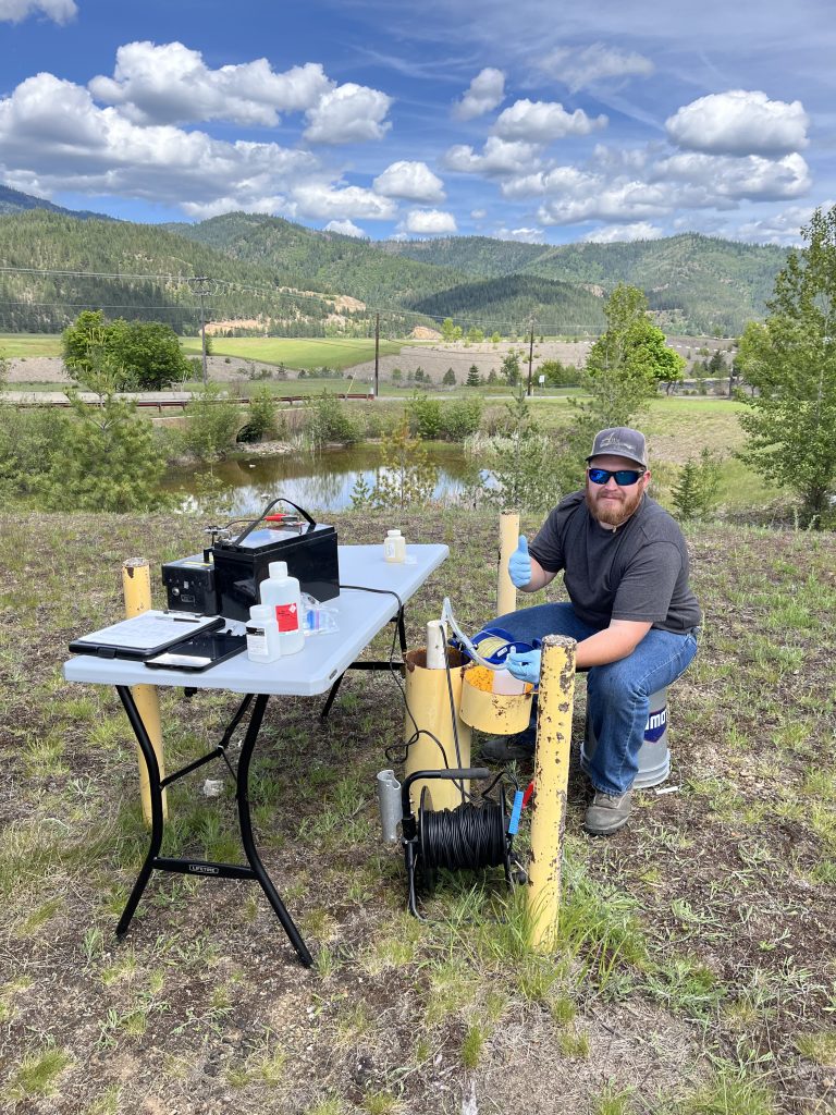
If you’ve spent time exploring the Coeur d’Alene Basin, you’ve probably noticed bright yellow posts scattered throughout the landscape. They can be found near repositories, along roadsides, and at various cleanup sites. While they may not look like much, these yellow markers represent an important part of the long-term effort to understand contamination and measure the success of certain cleanup activities.
The yellow posts or markers are called “bollards.” Many of these bollards identify and protect groundwater monitoring wells from damage from vehicles and heavy equipment. The wells are installed during site investigations and to conduct long-term monitoring of groundwater flow direction and groundwater quality. Before a well is installed, crews drill deep into the ground to collect soil samples and characterize subsurface contamination. These investigations help scientists determine the nature and extent of metals contamination below the surface and identify areas that may require remediation.
Once drilling is complete, the boreholes are often converted into monitoring wells. A typical monitoring well consists of a PVC pipe with specially designed screened intervals that allow groundwater to enter the well at specific depths. The PVC pipe is placed into the borehole. The open space between the PVC Pipe and the sides of the borehole is filled by carefully placing sand and sealing materials that ensure samples accurately represent groundwater conditions at the target depth.
These wells serve several important purposes. They allow scientists to measure groundwater elevations which are used to determine which direction the groundwater is moving underground and collect water samples to determine whether metals contamination is present in the groundwater. This information is critical because groundwater is the main source of drinking water in Idaho and can discharge into streams, rivers, and wetlands, potentially contributing to surface water contamination. Understanding these connections helps project managers design remedies that not only remove contaminated soil but also reduce ongoing groundwater contamination.
The monitoring wells also provide valuable information about the effectiveness of cleanup projects. Permanent monitoring locations have been established around repositories, the Central Impoundment Area (CIA), and other remediation sites throughout the Basin.
One recent success story comes from the groundwater collection system at the CIA. Monitoring data has shown improvements in water quality downstream of the collection system and Central Treatment Plant, providing evidence that the remedy is working as intended. These results help confirm that investments in remediation are reducing the movement of contamination into nearby waterways.
While a yellow bollard may seem insignificant, it marks a critical piece of a much larger monitoring network. Together, groundwater wells, surface water monitoring stations, and sediment sampling programs help scientists track contamination, evaluate cleanup effectiveness, and understand what is moving downstream toward Coeur d’Alene Lake. Organizations including EPA, Idaho Department of Environmental Quality (DEQ), the Coeur d’Alene Trust, and the U.S. Geological Survey all contribute to this monitoring effort. The data collected at these locations provides the information needed to make informed decisions and ensures that cleanup efforts continue to protect human health and the environment for generations to come.
The Dirt is a series of informative articles focused on all aspects of cleanup efforts associated with the Bunker Hill Superfund Site. Our goal is to promote community awareness of contamination issues, to provide tools for protecting public health, and to keep the community informed of current and future cleanup projects. The Dirt is a group of committed and local experts from multiple agencies, including the Basin Environmental Improvement Project Commission, Panhandle Health District, Shoshone County, Silver Valley Economic Development Corporation and the Idaho Department of Environmental Quality.
THE DIRT: When the Water Rises
The Lower Coeur d’Alene Basin is known for its scenic beauty, abundant wildlife, and popular recreation areas. While many locations appear clean and inviting, contamination from more than a century of mining activity remains a significant challenge. Lead-contaminated sediments continue to move through the river system, particularly during high-water events, creating ongoing concerns for human health and the environment.
One of the most difficult aspects of remediation in the Lower Basin is addressing recreational use areas. Beaches and shoreline access points naturally attract visitors, but these same areas can accumulate contaminated sediments during flooding. Protecting public health requires implementing remedies that can withstand future high-water events and reduce the risk of exposure to lead-contaminated soils and sediments.
A good example is the informal recreational use area across the river from the Black Rock Trailhead. As part of a pilot study at this particular site, portions of the beach area were replaced with riprap, layer of rocks, to reduce public contact with contaminated sediments. The effectiveness of this approach was demonstrated after a December flood event. Subsequent sampling of sediments deposited between the riprap found lead concentrations ranging from 4,500 to 5,000 milligrams per kilogram—four to five times higher than cleanup levels. These results showed that contaminated material was redistributed during the flood and reinforced the importance of using protective measures such as riprap in areas vulnerable to recontamination.
While placing riprap may make some areas less inviting for traditional beach activities, the goal is not to eliminate recreation. Rather, it is to create durable barriers that protect human health even when contaminated sediments are mobilized by flooding. Recontamination remains one of the primary factors influencing remedial decisions throughout the Lower Basin.
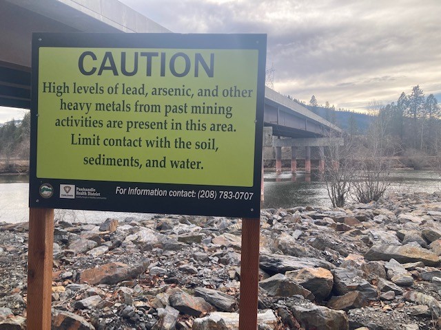
Warning signs posted throughout the Basin are not relics of the past—they remain relevant today. Agencies review conditions annually and continue to evaluate risks associated with recreational use. Visitors are encouraged to follow posted advisories and remain aware that contamination is still present in some areas.
Cleanup in the Basin follows a watershed approach, addressing sources of contamination from upstream to downstream. Reducing contamination in upstream areas will ultimately decrease the amount of lead transported into the Lower Basin and improve the long-term effectiveness of cleanup efforts. However, contaminated sediments remain in some recreational areas along the South Fork and throughout the Lower Basin. Until these areas are addressed, avoid direct contact with bare soil or sediment along the river and shoreline, particularly in areas where children may play. The best ways visitors can protect themselves while enjoying the Lower Basin is to heed signs and avoid known high lead areas, and to “Play Clean.” Wash hands before eating, drinking, or smoking, especially after spending time on beaches, shorelines, or riverbanks. Keep children from playing in bare soil or sediments and encourage them to wash their hands frequently. Remove contaminated sediment from belongings, clothing, blankets, toys, bags, watercraft, floaties and shoes before entering vehicles or homes to avoid tracking contaminated soil indoors. Be sure to rinse off pets that may have been playing in shoreline areas. Following posted signs and advisories is also important, as they identify locations where contamination may still pose a risk. By taking these simple precautions, residents and visitors can continue to enjoy the Lower Basin’s outstanding recreational opportunities while reducing their potential exposure to lead and other contaminants.
The Dirt is a series of informative articles focused on all aspects of cleanup efforts associated with the Bunker Hill Superfund Site. Our goal is to promote community awareness of contamination issues, to provide tools for protecting public health, and to keep the community informed of current and future cleanup projects. The Dirt is a group of committed and local experts from multiple agencies, including the Basin Environmental Improvement Project Commission, Panhandle Health District, Shoshone County, Silver Valley Economic Development Corporation and the Idaho Department of Environmental Quality.