

Category: Uncategorized
THE DIRT: What are bollard and what do they do?
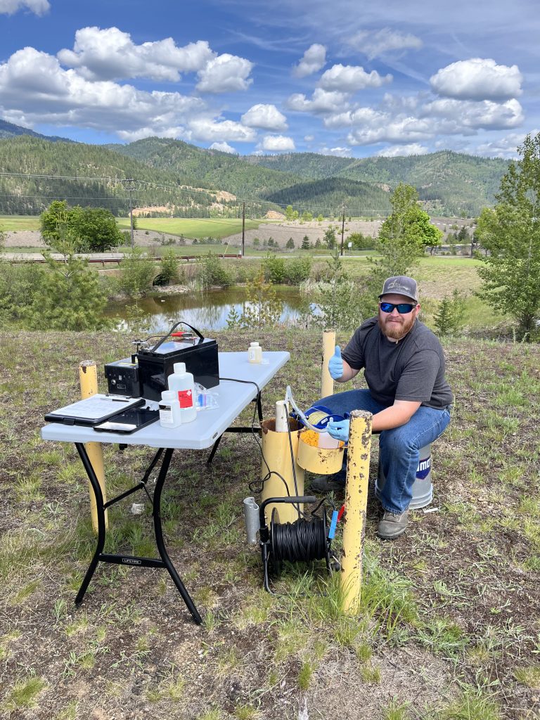
If you’ve spent time exploring the Coeur d’Alene Basin, you’ve probably noticed bright yellow posts scattered throughout the landscape. They can be found near repositories, along roadsides, and at various cleanup sites. While they may not look like much, these yellow markers represent an important part of the long-term effort to understand contamination and measure the success of certain cleanup activities.
The yellow posts or markers are called “bollards.” Many of these bollards identify and protect groundwater monitoring wells from damage from vehicles and heavy equipment. The wells are installed during site investigations and to conduct long-term monitoring of groundwater flow direction and groundwater quality. Before a well is installed, crews drill deep into the ground to collect soil samples and characterize subsurface contamination. These investigations help scientists determine the nature and extent of metals contamination below the surface and identify areas that may require remediation.
Once drilling is complete, the boreholes are often converted into monitoring wells. A typical monitoring well consists of a PVC pipe with specially designed screened intervals that allow groundwater to enter the well at specific depths. The PVC pipe is placed into the borehole. The open space between the PVC Pipe and the sides of the borehole is filled by carefully placing sand and sealing materials that ensure samples accurately represent groundwater conditions at the target depth.
These wells serve several important purposes. They allow scientists to measure groundwater elevations which are used to determine which direction the groundwater is moving underground and collect water samples to determine whether metals contamination is present in the groundwater. This information is critical because groundwater is the main source of drinking water in Idaho and can discharge into streams, rivers, and wetlands, potentially contributing to surface water contamination. Understanding these connections helps project managers design remedies that not only remove contaminated soil but also reduce ongoing groundwater contamination.
The monitoring wells also provide valuable information about the effectiveness of cleanup projects. Permanent monitoring locations have been established around repositories, the Central Impoundment Area (CIA), and other remediation sites throughout the Basin.
One recent success story comes from the groundwater collection system at the CIA. Monitoring data has shown improvements in water quality downstream of the collection system and Central Treatment Plant, providing evidence that the remedy is working as intended. These results help confirm that investments in remediation are reducing the movement of contamination into nearby waterways.
While a yellow bollard may seem insignificant, it marks a critical piece of a much larger monitoring network. Together, groundwater wells, surface water monitoring stations, and sediment sampling programs help scientists track contamination, evaluate cleanup effectiveness, and understand what is moving downstream toward Coeur d’Alene Lake. Organizations including EPA, Idaho Department of Environmental Quality (DEQ), the Coeur d’Alene Trust, and the U.S. Geological Survey all contribute to this monitoring effort. The data collected at these locations provides the information needed to make informed decisions and ensures that cleanup efforts continue to protect human health and the environment for generations to come.
The Dirt is a series of informative articles focused on all aspects of cleanup efforts associated with the Bunker Hill Superfund Site. Our goal is to promote community awareness of contamination issues, to provide tools for protecting public health, and to keep the community informed of current and future cleanup projects. The Dirt is a group of committed and local experts from multiple agencies, including the Basin Environmental Improvement Project Commission, Panhandle Health District, Shoshone County, Silver Valley Economic Development Corporation and the Idaho Department of Environmental Quality.
THE DIRT: When the Water Rises
The Lower Coeur d’Alene Basin is known for its scenic beauty, abundant wildlife, and popular recreation areas. While many locations appear clean and inviting, contamination from more than a century of mining activity remains a significant challenge. Lead-contaminated sediments continue to move through the river system, particularly during high-water events, creating ongoing concerns for human health and the environment.
One of the most difficult aspects of remediation in the Lower Basin is addressing recreational use areas. Beaches and shoreline access points naturally attract visitors, but these same areas can accumulate contaminated sediments during flooding. Protecting public health requires implementing remedies that can withstand future high-water events and reduce the risk of exposure to lead-contaminated soils and sediments.
A good example is the informal recreational use area across the river from the Black Rock Trailhead. As part of a pilot study at this particular site, portions of the beach area were replaced with riprap, layer of rocks, to reduce public contact with contaminated sediments. The effectiveness of this approach was demonstrated after a December flood event. Subsequent sampling of sediments deposited between the riprap found lead concentrations ranging from 4,500 to 5,000 milligrams per kilogram—four to five times higher than cleanup levels. These results showed that contaminated material was redistributed during the flood and reinforced the importance of using protective measures such as riprap in areas vulnerable to recontamination.
While placing riprap may make some areas less inviting for traditional beach activities, the goal is not to eliminate recreation. Rather, it is to create durable barriers that protect human health even when contaminated sediments are mobilized by flooding. Recontamination remains one of the primary factors influencing remedial decisions throughout the Lower Basin.
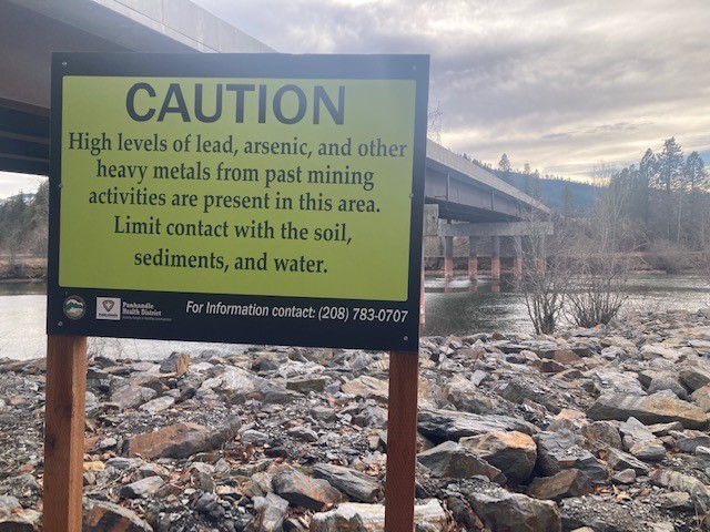
Warning signs posted throughout the Basin are not relics of the past—they remain relevant today. Agencies review conditions annually and continue to evaluate risks associated with recreational use. Visitors are encouraged to follow posted advisories and remain aware that contamination is still present in some areas.
Cleanup in the Basin follows a watershed approach, addressing sources of contamination from upstream to downstream. Reducing contamination in upstream areas will ultimately decrease the amount of lead transported into the Lower Basin and improve the long-term effectiveness of cleanup efforts. However, contaminated sediments remain in some recreational areas along the South Fork and throughout the Lower Basin. Until these areas are addressed, avoid direct contact with bare soil or sediment along the river and shoreline, particularly in areas where children may play. The best ways visitors can protect themselves while enjoying the Lower Basin is to heed signs and avoid known high lead areas, and to “Play Clean.” Wash hands before eating, drinking, or smoking, especially after spending time on beaches, shorelines, or riverbanks. Keep children from playing in bare soil or sediments and encourage them to wash their hands frequently. Remove contaminated sediment from belongings, clothing, blankets, toys, bags, watercraft, floaties and shoes before entering vehicles or homes to avoid tracking contaminated soil indoors. Be sure to rinse off pets that may have been playing in shoreline areas. Following posted signs and advisories is also important, as they identify locations where contamination may still pose a risk. By taking these simple precautions, residents and visitors can continue to enjoy the Lower Basin’s outstanding recreational opportunities while reducing their potential exposure to lead and other contaminants.
The Dirt is a series of informative articles focused on all aspects of cleanup efforts associated with the Bunker Hill Superfund Site. Our goal is to promote community awareness of contamination issues, to provide tools for protecting public health, and to keep the community informed of current and future cleanup projects. The Dirt is a group of committed and local experts from multiple agencies, including the Basin Environmental Improvement Project Commission, Panhandle Health District, Shoshone County, Silver Valley Economic Development Corporation and the Idaho Department of Environmental Quality.
THE DIRT: Hunting in a superfund site

Fall is in the air. The nights are getting cooler, the days are getting shorter, and for many people across North Idaho, that means hunting season is here.
North Idaho offers abundant access to public lands and some of the region’s best hunting opportunities. But in the Silver Valley, hunters may notice a few changes this year as properties are cleaned up and communities add new recreation opportunities.
One area where access has changed is around the Smelterville Airport. The Idaho Department of Environmental Quality (DEQ) has historically allowed hunting on portions of its property, particularly west of the airport and outside city limits in the Government Gulch and Grouse Gulch areas.
However, the area immediately around the airport is changing. With remedial work completed and the addition of Idaho Parks and Recreation’s new campground, the Airport Riverwalk area will no longer be open to hunting. Across the way, Mountain View Park is also now closed to hunting. The City of Kellogg has developed the property as a recreation area, and both locations are seeing increased use by recreationalists. Closing these areas hunting helps provide a safer environment for everyone.
That doesn’t mean hunting opportunities are disappearing from the Silver Valley. There are still many public lands throughout the region where hunting is allowed. As always, hunters should know the boundaries of public and private property and obtain permission before hunting on private land.
If you hunt within or near the Bunker Hill Superfund Site, there are a few additional precautions worth keeping in mind.
Some areas of the Coeur d’Alene Basin have been cleaned up, but contamination remains in portions of the Basin, particularly in areas that have seen less human activity. Wildlife can move through and feed in these areas, so it is important to follow posted warnings and health advisories.
To reduce potential exposure:
- Don’t eat the soft tissues of wild game or waterfowl harvested from contaminated areas. Wildlife can be exposed to metals while feeding in contaminated areas.
- Pay attention to warning signs and follow posted guidance. Signs are there to help you identify areas where additional precautions are needed.
- Keep contaminated soil out of your home. Before leaving the site, and before entering your house, remove mud and dirt from boots, shoes and clothing. Wash muddy clothing separately from other laundry.
- Wash your hands with clean water before eating, drinking, smoking or chewing tobacco.
- Keep hunting equipment and vehicles clean if you have been in muddy or potentially contaminated areas.
These simple steps can help reduce the chance of bringing contaminated soil into your home or being exposed to contaminants while enjoying the outdoors.
The Bunker Hill Superfund Site encompasses a large and diverse area, and cleanup continues to make more places safe for people to live and recreate. At the same time, knowing where contamination may remain and following posted guidance is an important part of enjoying the Basin safely.
For more information about safe recreation in the Coeur d’Alene Basin, visit cdabasin.idaho.gov/safe-recreation/.
The Dirt is a series of informative articles focused on all aspects of cleanup efforts associated with the Bunker Hill Superfund Site. Our goal is to promote community awareness of contamination issues, to provide tools for protecting public health, and to keep the community informed of current and future cleanup projects. The Dirt is a group of committed and local experts from multiple agencies, including the Basin Environmental Improvement Project Commission, Panhandle Health District, Shoshone County, Silver Valley Economic Development Corporation and the Idaho Department of Environmental Quality.
THE DIRT: Buggin’ Out
Water quality can be measured in many ways. Some tests involve collecting water samples and analyzing them in a laboratory to determine whether the water is safe for human consumption. Other tests evaluate conditions that affect fish and other aquatic species. While these methods provide valuable information, scientists can also assess the health of a waterbody by examining the organisms that live within it.
Aquatic ecosystems are supported by a complex food web that begins with small organisms. Some, such as zooplankton, are microscopic and difficult to see with the naked eye. Others are larger and more visible. These aquatic “bugs,” known as macroinvertebrates, live among rocks, vegetation, and sediments in streams, rivers, and lakes. Their presence can tell an important story about the health of a waterbody and the life it can support.
Macroinvertebrates are small animals without backbones and include aquatic insects, crustaceans, worms, and snails. They form the foundation of aquatic food webs and serve as an important food source for fish, amphibians, and birds. Because many macroinvertebrates spend months or even years in the same area and cannot easily escape pollution, they are widely used as indicators of water quality.
Some species, such as stoneflies, mayflies, and caddisflies, are highly sensitive to pollution and require cool, clean, oxygen-rich water to survive. Other organisms, including aquatic worms, midge larvae, and some leech species, are more tolerant of pollution and lower oxygen levels. By identifying which macroinvertebrates are present, scientists can develop a biological assessment of stream health and detect potential water quality problems.
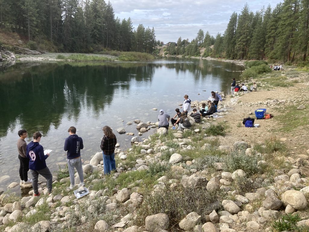
During The Confluence Project’s water quality field trips, students often collect and identify macroinvertebrates to help assess watershed health. Wearing waders or muck boots, participants use a kick net to sample rocks and vegetation in the stream. The collected organisms are then placed in a bucket of water, allowing sediment to settle and the tiny creatures to become visible. Using a plastic spoon or pipette, students carefully transfer the organisms to a magnifier for identification.
Once the macroinvertebrates have been identified, students can calculate a biotic index, which provides a general indication of water quality. Finding pollution-sensitive species, such as stoneflies, mayflies, and caddisflies, often suggests a healthy aquatic ecosystem. In contrast, a community dominated by more pollution-tolerant organisms may indicate environmental stress or degraded water quality.
Scientists continue to use macroinvertebrate monitoring today because it provides valuable information about water quality over time. While a single water sample offers a snapshot of conditions at a specific moment, macroinvertebrates reflect the cumulative effects of water quality on aquatic life over weeks, months, or even years. By combining biological monitoring with traditional water chemistry data, researchers can gain a more complete understanding of ecosystem health.
For example, during the past year, the U.S. Fish and Wildlife Service conducted macroinvertebrate sampling near the Central Impoundment Area to evaluate how upgrades to the Central Treatment Plant may be affecting aquatic life in the South Fork Coeur d’Alene River. The macroinvertebrate data, combined with seasonal water-quality sampling, help scientists assess not only changes in water chemistry but also how those changes are influencing the organisms that live in the river. Together, these monitoring efforts provide a more comprehensive picture of the effectiveness of the remedy and its impact on overall water quality.
These tiny creatures may not look impressive at first glance, but they play a critical role in aquatic ecosystems and provide valuable clues about the health of our waterways.
The Dirt is a series of informative articles focused on all aspects of cleanup efforts associated with the Bunker Hill Superfund Site. Our goal is to promote community awareness of contamination issues, to provide tools for protecting public health, and to keep the community informed of current and future cleanup projects. The Dirt is a group of committed and local experts from multiple agencies, including the Basin Environmental Improvement Project Commission, Panhandle Health District, Shoshone County, Silver Valley Economic Development Corporation and the Idaho Department of Environmental Quality.
THE DIRT: Where Trails Meet Tranquility: New Campground Prioritizes Access and Experience
A new bicycle and pedestrian-friendly campground in Smelterville opened in May, offering visitors a unique, low-impact outdoor experience near the Trail of the Coeur d’Alenes. Located off Airport Road on the north side of Interstate 90, the campground includes 26 campsites, two of which are fully ADA-accessible. The accessible sites feature pathways connecting the trailhead parking area directly to the campsites.
Designed primarily as a bike-in or walk-in campground, the site encourages visitors to arrive without a vehicle. A 22-stall parking lot is available inside a gated area on a first-come, first-served basis. Not every campsite will accommodate a vehicle, and some visitors may need to park and walk up to 1,000 feet to reach their site. The campground road is approximately 10 feet wide with shoulders, but vehicle access beyond the gate is restricted to those with reservations.
Each campsite includes a bike rack and picnic table, while 11 sites also have hammock posts. The campground offers tent pads, a centrally located shower house with four stalls, flushable toilets, sinks, electrical outlets, and power for charging devices. Two e-bike charging stations are available—one near the shower house and another at the campground entrance. Visitors must bring their own chargers.
The campground supports Class 1 and Class 2 e-bikes, but not Class 3 e-bikes. The trail speed limit is 15 mph. ADA users may request an OPDMD permit through Idaho Parks and Recreation to use qualifying mobility devices. Dogs are welcome but must remain leashed, and owners are required to clean up after them.
The campground is located in an area that has undergone extensive environmental cleanup. Visitors should remain on designated paved and gravel surfaces because surrounding areas have not been fully remediated. In particular, soils in areas below the high-water mark may still contain elevated levels of heavy metals. Avoid disturbing these soils and follow posted signs and access restrictions.
Just east of the campground, cleanup at East Smelterville Flats has also transformed a former contaminated site into a safer recreational area. Phase 2 of the cleanup was completed this summer. The work included installing a new 12-inch clean soil cap, revegetating the 14-acre site, adding gravel walking paths, and installing four concrete pads for future picnic areas. Interpretive signage will help visitors understand both the area’s history and the environmental cleanup that has taken place.
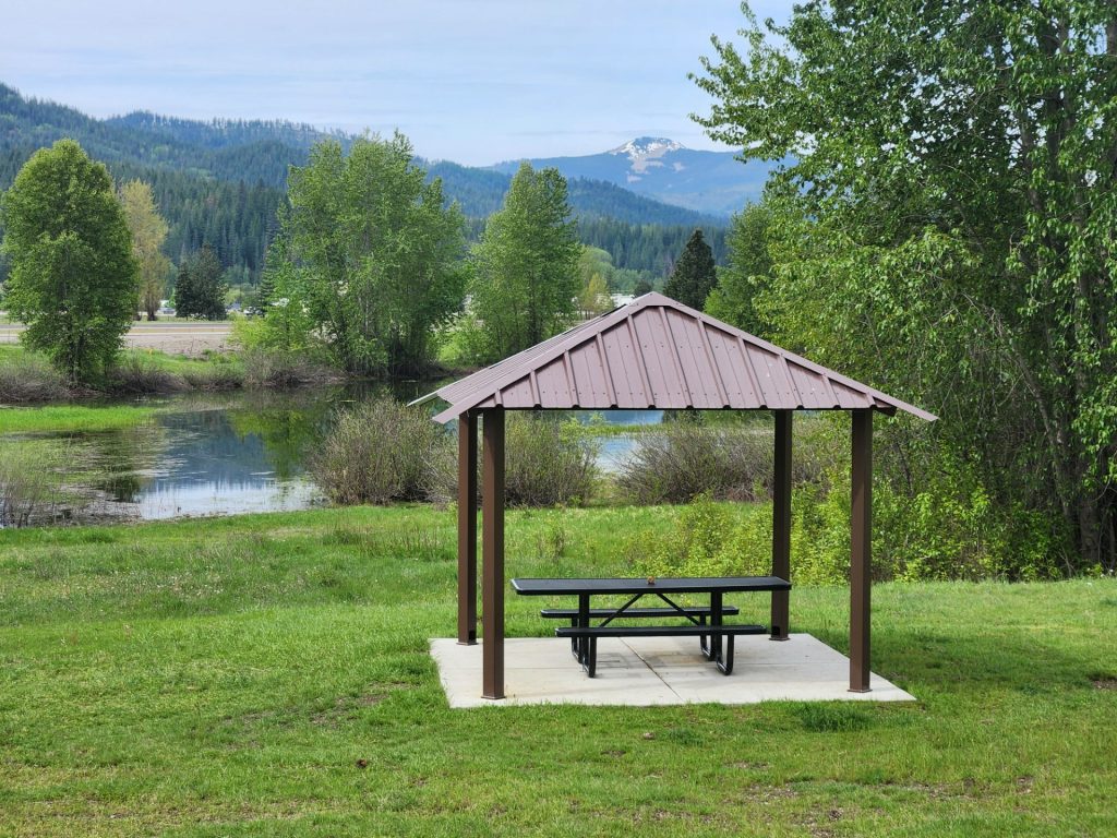
A new shade structure and picnic table, installed by the Kootenai Realtors Association just west of the Airport Riverwalk parking lot, provide another place for visitors to rest and enjoy the area. This fall, additional interpretive signs covering local history and environmental cleanup efforts will be installed.
Future plans include a trail connection between the campground and the Pinehurst Trailhead, pending agreements and funding.
Together, these projects demonstrate how cleanup and recreation can work hand in hand—protecting people from historical contamination while creating new opportunities to bike, walk, camp, and learn about the ongoing restoration of the Silver Valley.
THE DIRT: Part 2: From Tailings Pond to Engineered Repository—The Story Behind Page
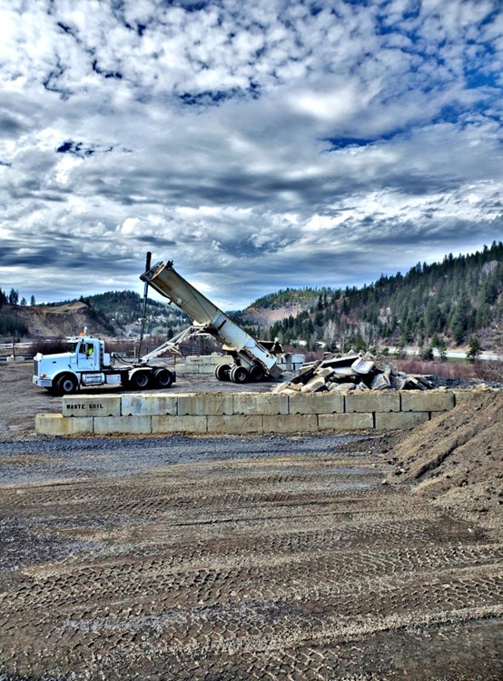
At first glance, the Page Repository seems like an unusual place for an environmental cleanup project. Why would engineers build a repository in what appears to be a wetland?
The answer begins more than a century ago.
Long before the repository existed, the site served as the Page Mine tailings pond, where fine mining waste was deposited for decades. Those tailings contained elevated concentrations of lead and other metals, creating a long-term source of contamination.
When mining operations ended, the exposed tailings presented another problem. As they dried, fine contaminated particles became airborne, creating dust that posed a risk to nearby communities.
To prevent that from happening, cleanup managers intentionally maintained water over much of the former tailings pond. A water-control structure, known as a weir, was installed on the west end of the Page Swamp to maintain a relatively constant water level. During wet periods, the tiered weir allows excess water to flow downstream. During dry periods, it retains water over the tailings, preventing them from drying out and becoming mobile through wind erosion.
Over time, vegetation became established, wildlife colonized the area, and portions of the former industrial site developed wetland characteristics. Although these wetlands resulted from historic mining activities and subsequent cleanup actions—not natural processes—they became regulated under the Clean Water Act.
As engineers planned each repository expansion, wetland impacts were carefully evaluated through formal wetland delineations documented in the design reports. Federal law required those impacts to be compensated through wetland mitigation. Projects such as the West End Natural Infrastructure (WENI) project and later restoration work at Robinson Creek created and enhanced wetlands that replaced lost wetland functions while supporting the continued cleanup of contaminated mine waste.
The concrete foundation visible today is another part of that long-term engineering strategy. The repository design calls for concrete or quarry rock beneath the disposal area to create a stable platform above the saturated ground. This foundation supports heavy equipment, minimizes settlement, and helps isolate contaminated materials from groundwater.
Stormwater management is a critical component of protecting water quality at the Page Repository. The repository is engineered with a tightly compacted surface that minimizes the amount of stormwater that comes into contact with the waste material. Surface runoff is directed to drywells, which convey the water into the engineered foundation beneath the repository. This design reduces the time stormwater is in contact with the waste while preventing erosion and uncontrolled runoff. Best management practices are also used to capture and remove sediment from stormwater before it enters the drywells, where it joins the water managed within the foundation system.
To verify that these engineering controls are working as intended, scientists monitor water quality at 14 locations around the Page Repository, including eight groundwater monitoring wells and six surface water sampling sites. Water samples are collected twice each year during both high-flow and low-flow conditions and analyzed for metals as well as key water quality indicators such as dissolved oxygen, pH, conductivity, and oxidation-reduction potential.
Once the engineered foundation is complete, contaminated soils are placed in controlled lifts over many years. The repository ultimately will reach approximately 60 feet of engineered fill before reaching its design capacity. Throughout construction, engineers carefully limit how much material is placed each season to maintain stability and allow the underlying foundation to settle as designed.
When repository operations are complete, the contaminated materials will be covered with an engineered cap that minimizes rain and snowmelt infiltration. Reducing the amount of water that moves through contaminated waste is one of the most effective ways to limit the movement of dissolved metals into groundwater and nearby streams.
The Page Repository represents decades of careful engineering and environmental planning. What may appear to be a pile of concrete is actually a critical component of an engineered system designed to safely contain contaminated mine waste, protect water quality, and support the continued cleanup of the Coeur d’Alene Basin for years to come.
THE DIRT: The Page Repository Pt. 1 – New life for the 34-year-old facility
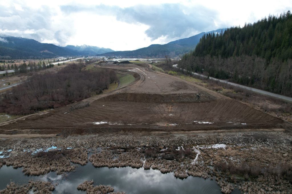
If you’ve driven past the Page Repository recently, you’ve probably noticed a large stockpile of concrete and wondered what’s going on. Why is so much concrete being brought to the repository? Why is it being placed in what appears to be a wetland? And how does it fit into the environmental cleanup of the Coeur d’Alene Basin?
The answer starts with understanding what the Page Repository is—and what it isn’t.
The Page Repository is not a municipal landfill. It is a specially engineered disposal facility built as part of the Bunker Hill Superfund cleanup to safely contain contaminated soil and mine waste generated by cleanup projects throughout the Box. EPA envisioned the repository in its 1992 Operable Unit 2 Record of Decision as a permanent location where contaminated materials could be consolidated, isolated, and eventually capped to protect human health and the environment. The repository currently accepts waste from remedial actions, the Institutional Controls Program, Roads Program, and Basin Property Remediation Program. Page Repository is designed and operated by IDEQ. It allows those in the Box to have a place to put their contaminated soil making it vitally important for the community.
One feature many people don’t realize is that the repository was designed to use clean, durable construction materials as part of its engineered foundation. Rather than purchasing thousands of cubic yards of quarry rock, engineers can use concrete from construction projects if it meets engineering specifications.
Think of it like building a house. Before you pour the floor or build the walls, you first need a solid foundation. At Page, the concrete isn’t waste being buried. Instead, it forms the structural base that supports future layers of contaminated soil while providing long-term stability for heavy equipment and decades of repository use.
Engineers designed the repository so only about five feet of contaminated material can be added each construction season. This controlled loading allows the underlying materials time to settle before additional weight is placed on top. Adding too much weight too quickly could affect long-term stability, so construction occurs in carefully planned stages. Engineers monitor the repository throughout construction and placement of waste for geotechnical stability.
The repository was originally designed to receive roughly 15,000 cubic yards of contaminated material each year, but recent cleanup projects are generating closer to 30,000 cubic yards annually. Preparing additional foundation now helps ensure the repository can safely accommodate those higher volumes.
Some people have wondered why the current concrete stockpile appears so much larger than in the past. Higher volumes of contaminated soil require additional repository capacity, and engineers are constructing the foundation for Cell 6 exactly as called for in the approved design. In addition, the west end of the swamp is deeper requiring more material for the foundation construction. Similar work has occurred during previous repository expansions, but recent work on I-90 has provided much of the concrete needed for expansion. Reusing concrete makes good financial sense. Instead of paying to dispose of clean concrete in a landfill, the material can be beneficially reused in the repository. In addition, the Idaho Department of Environmental Quality (DEQ), does not have to pay for purchasing materials for the foundation. If suitable concrete and rock weren’t available from local construction projects, they would have to purchase and haul rock from commercial quarries. At an estimated cost of about $50 per cubic yard before transportation, buying all of that material could cost more than $7.5 million.
They are currently stockpiling the concrete at Page to build out Cell 6. Later in the season contractors will remove reinforcing steel and process the concrete, so the pieces meet design specifications. Pieces that are too small create excess fine material, while larger pieces do not compact properly. Every source is reviewed by DEQ, the repository operator, and the Engineer of Record before it becomes part of the repository.
The current work taking place in Cell 6 is deeper than in previous expansion areas. Because of these softer underlying conditions, engineers designed Cell 6 with additional foundation material to provide the necessary support while maintaining the finished repository at least one foot above the 100-year flood elevation. Once this foundation work is complete, no further foundation expansion is planned.
Large pieces of concrete have been incorporated into the repository since its early expansions. Water-quality monitoring has not shown adverse impacts associated with this practice. As planning begins for the repository’s next expansion, additional water-quality testing will help guide future design decisions.
In our next article, we’ll explore why the repository is located where it is, how a former tailings pond became a regulated wetland, and why managing water at the site has always been one of the keys to protecting water quality throughout the Basin.
• • •
The Dirt is a series of informative articles focused on all aspects of cleanup efforts associated with the Bunker Hill Superfund Site. Our goal is to promote community awareness of contamination issues, to provide tools for protecting public health, and to keep the community informed of current and future cleanup projects. The Dirt is a group of committed and local experts from multiple agencies, including the Basin Environmental Improvement Project Commission, Panhandle Health District, Shoshone County, Silver Valley Economic Development Corporation, and the Idaho Department of Environmental Quality.
THE DIRT: Annual Basin tour to explore lower regions
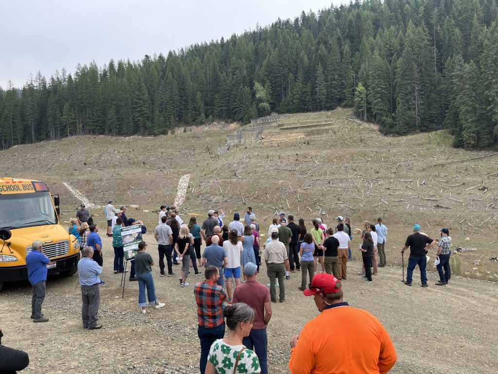
Join the Basin Environmental Improvement Project Commission (BEIPC) for its annual Basin Tour on Wednesday, July 29, from 9:30 a.m. to 3:30 p.m. This year’s tour will focus on the Lower Basin, highlighting both remediation and restoration efforts that are improving water quality, habitat, and ecosystem health throughout the watershed.
The annual tour gives commissioners and members of the public an opportunity to see completed projects, ongoing work, and future priorities. Because of the size and complexity of the Coeur d’Alene Basin, tour locations rotate among the Upper Basin, Lower Basin, and Box.
The day will begin at Scheffelmaier’s Country Barn, where participants will receive project updates and a preview of the sites to be visited.
The first field stop will be the Hepton Lake Willow Nursery near St. Maries, ID where Coeur d’Alene Tribal staff will discuss restoration efforts designed to improve wetland habitat, water quality, and native fish populations while controlling invasive species. Participants will also tour the Native Willow Nursery, which provides plant materials for Restoration Partnership projects throughout the Basin.
During lunch at Aqua Park in St. Maries, representatives from the Inland Northwest Land Conservancy will discuss their conservation efforts within one of their priority areas, the Coeur d’Alene River and the important role land protection plays in supporting restoration projects.
The tour will then visit Grays Meadow, with Idaho Dept. of Fish and Game where approximately 700 acres of contaminated agricultural fields have been remediated and restored to wetlands supporting waterfowl and other wildlife habitats. This agricultural to wetland conversion project will also increase the amount of functioning, high quality habitat, and improve nutrient filtering and water quality. Participants will view both the east and west fields and learn about the project’s benefits for wildlife, water quality, and ecosystem function.
The final stop will be Rose Lake, where the U.S. Geological Survey will discuss new sediment monitoring stations installed to help track sediment movement down the Lower Coeur d’Alene River and into Coeur d’Alene Lake.
As an added bonus, attendees will receive a Bird Bingo card and have the chance to win prizes throughout the day. The Lower Basin is a haven for migratory birds and waterfowl, making it the perfect place to test your bird-spotting skills while exploring some of the Lower Basin’s most important restoration sites.
Registration is required, and seating is limited.
To reserve a seat, contact:
Gail Yost, Executive Director’s Assistant
📧 gail.yost@deq.idaho.gov
📞 208-783-2548
For updates and the full agenda, visit www.basincommission.com.
THE DIRT: The Confluence Project in the Silver Valley
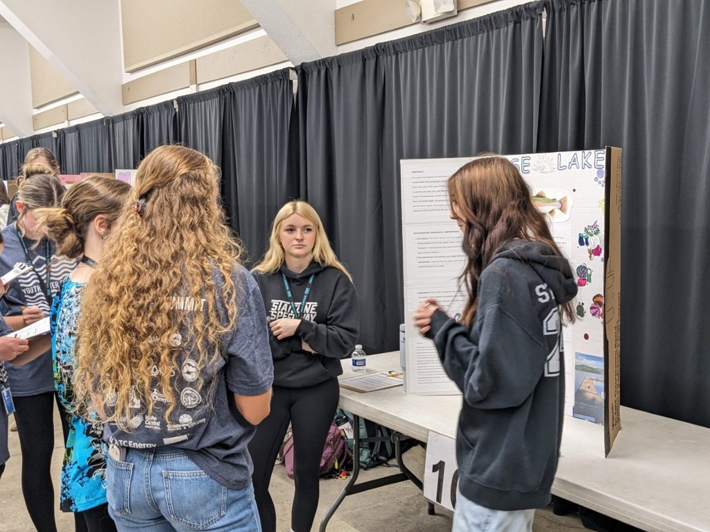
For many years, students from Kellogg and Wallace High Schools have participated in the Confluence Project, a year-long water science program that connects classroom learning with real-world environmental research. Sponsored by the University of Idaho and supported by numerous agencies and local governments, the program provides students with hands-on opportunities to explore the Coeur d’Alene Basin watershed and the challenges facing its natural resources.
Each fall, students head into the field to investigate local waterways and assess stream health through chemical, physical, and biological monitoring. Kellogg students study Jackass Creek, while Wallace students conduct research on the South Fork Coeur d’Alene River. Both waterways have been affected by historic mining contamination and continue to face environmental pressures, including rising water temperatures and changing stream conditions.
Through these field studies, students collect and analyze data to better understand the health of aquatic ecosystems and the species that depend on them. Along the way, they learn about the history of the watershed, the impacts of human activities, and the importance of protecting water resources for future generations.
Another highlight of the program is snowpack monitoring. Students go to Lookout Pass during the winter to measure snow levels and learn how mountain snowpack functions as a natural water reservoir. They discover how snowmelt sustains rivers and streams throughout the spring and summer, and how declining snowpack can reduce stream flows, increase water temperatures, and create challenging conditions for fish and wildlife.
The lessons learned through the Confluence Project often stay with students long after they leave the classroom. During a field excursion last fall, a former participant joined the group and immediately noticed that water levels in the creek were significantly lower than in previous years. The observation demonstrated not only an enduring connection to the watershed but also one of the most important skills in science: careful observation.
The program’s impact extends far beyond data collection. Students are encouraged to connect their own interests and passions with science and environmental stewardship. Many finish the year with greater confidence in their abilities and a new appreciation for careers in science, natural resources, and environmental management.
Wallace High School teacher Jennifer Murray has seen firsthand how the program engages students.
“We first learn about rivers and how to measure water quality and assess the health of a river. Students enjoy walking to the river to do this hands-on assessment. In February, we go to Lookout to measure snowpack and compare our data to the SNOTEL records to see how snow levels have changed over the past 70 years. Students then choose a topic related to the Coeur d’Alene Watershed to investigate and present at the Youth Water Summit. It’s a great opportunity for students to learn alongside other schools and science professionals while developing a deeper understanding of their watershed.”
2025 Youth Water Summit Award Winners
Kellogg High School
- First Place: Isabella Hollis and Nevaeh Schabell
- How does oil pollution affect the aquatic environment?
- Second Place: Richard Bewick, Gabe Johnson, and Darren Ruggabe
- Water Quality & Swimming
- Third Place: Abie Torres and McKayla Sims
- Overall Effects of Lead Pollution at Bull Run Lake
Wallace High School
- First Place: Ashley Schwartz and Kora Foust
- Rose Lake, Dual Threats from Metals and Microplastics
- Second Place: Anthony Frank
- Human Waste in the Waters…
- Third Place: Henry Larson and Marley Pearce
- The Fork Off
Through programs like the Confluence Project, local students are gaining the knowledge, skills, and experiences needed to become the next generation of watershed stewards and community leaders.
The Dirt is a series of informative articles focused on all aspects of cleanup efforts associated with the Bunker Hill Superfund Site. Our goal is to promote community awareness of contamination issues, to provide tools for protecting public health, and to keep the community informed of current and future cleanup projects. The Dirt is a group of committed and local experts from multiple agencies including the Basin Environmental Improvement Project Commission, Panhandle Health District, Shoshone County, Silver Valley Economic Development Corporation, and the Idaho Department of Environmental Quality.
THE DIRT: Innovative Wastewater Project in Kingston-Cataldo Blends Infrastructure Upgrades with Environmental Benefits
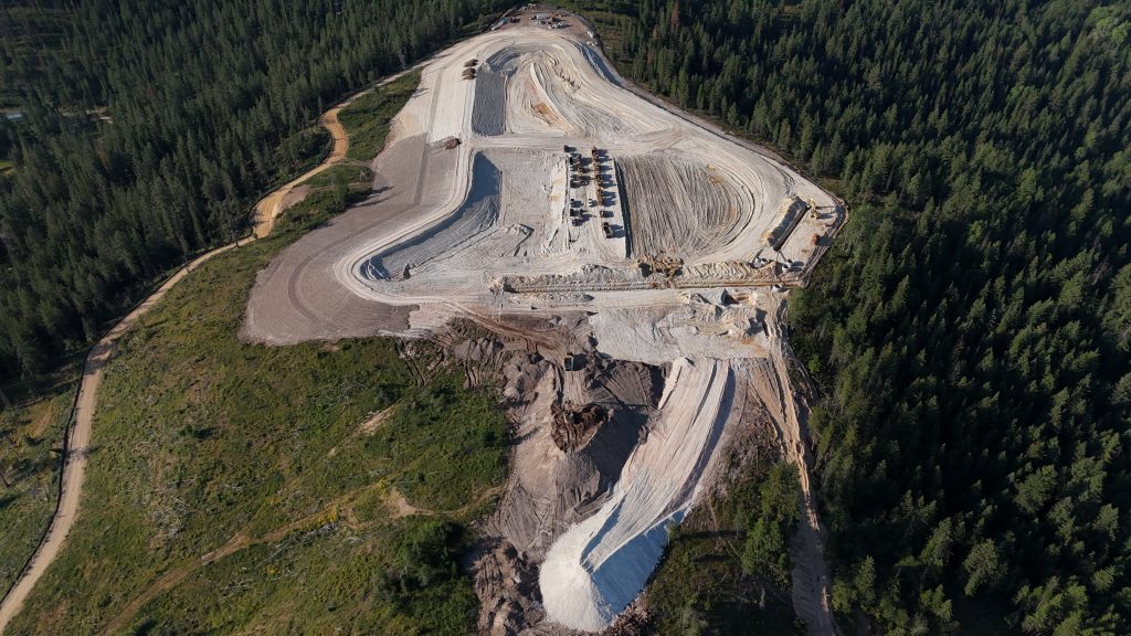
KINGSTON, ID — The Kingston-Cataldo Sewer District is redefining what infrastructure can achieve. By pivoting to an innovative land application treatment approach, the District is securing future capacity and self-sustainability while cultivating a thriving local ecosystem.
Faced with current user rates averaging $72 per month per housing unit, the district began exploring alternative treatment methods to control future costs while maintaining effective service. Those efforts led to the development of a land application facility, funded through a combination of support from the Idaho Department of Environmental Quality (DEQ), ARPA funds, and Leading Idaho grants.
Construction on the project began approximately one year ago and is expected to reach completion this summer. Once operational, all customer flows will be directed to the new facility. When the construction phase is completed, the system will undergo rigorous “clean water” testing before going fully operational.
Beyond its primary function of wastewater treatment, the project has sparked unexpected and valuable conservation partnerships. The Idaho Fish and Wildlife Office (IFWO) expressed interest in enhancing the site by providing native wildflower seeds. What began as a plan for 20 acres quickly grew to 40 acres with additional support, including a donation from Avista Utilities.
In total, 52 acres will be irrigated during the driest part of the summer. The irrigation will be a vital hydration source for the landscape while simultaneously providing critical support to local pollinators. Plans also include planting additional milkweed, generously donated by WingsRising Inc. of CDA, to benefit monarch butterflies, a species identified as a “species of greatest conservation need” in Idaho. The milkweed serves as an essential food source for monarch larvae.
The project has also yielded surprising geological discoveries. During excavation, crews encountered consistent clay deposits extending 55 feet deep—an unexpected find in what was assumed to be rocky terrain. This fine, talc-like clay proved ideal for construction purposes such as retaining walls and compaction.
In a unique collaboration showcasing local circularity, some of the clay was donated to Priest Lake potter Brad Sondahl. Sondahl has been exploring the material’s use in pottery, creating complimentary coffee mugs for the sewer district without impacting the project’s budget or timeline.
Additional enhancements are currently in progress, including hydroseeding following irrigation installation. The district is considering another IFWO recommendation to use a native seed blend instead of a standard dryland grass mixture to ensure better long-term survival and ecological resilience. While the native blend may incur a small increase in cost, it is expected to serve as a prototype for similar facilities in the future.
The project will ultimately transition approximately 350 connections to the new system, reducing flows to the South Fork Sewer District and increasing capacity for the region. Overall, the initiative represents a forward-thinking, collaborative solution that benefits both the local community and the Idaho environment.
By choosing ecological integrity over the status quo, the Kingston-Cataldo Sewer District is proving that wastewater management doesn’t just have to be about “disposal”—it can be about renewal.