

Category: Uncategorized
THE DIRT: Drought conditions increase exposure risks
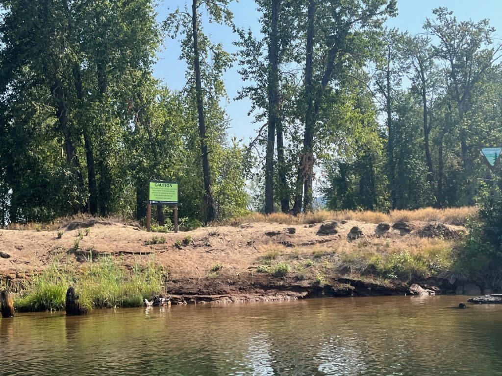
Winter in North Idaho has been an odd one this year. From December flooding to an unseasonably dry & warm February, to several severe windstorms, North Idaho has certainly been through the ringer. Precipitation and snowpack deficits over the past four years have also contributed to a multi-year drought in our region that persists today.
Despite late-season snowfall, snowpack remained below normal for the 2026 water year, as a larger portion of precipitation fell as rain rather than snow. To make matters worse, current climate outlooks forecast dry and warm spring conditions and warmer than normal summer temperatures. Drought conditions bring on an abundance of various concerns such as forest fires and water restrictions, but for those living, working, or recreating in the Bunker Hill Superfund Site, a not so commonly known concern is the increased risk of lead exposure.
While thousands of properties in the superfund site have been cleaned up through remedial actions, contaminated areas are still present, even in some popular recreational areas. When droughts occur, soil dries out much faster, leading to dustier than normal conditions. If dust is kicked up or disturbed in these contaminated areas, exposure is extremely difficult to prevent. Dust particles stick to clothing, shoes, towels, pets, etc., and are easily tracked into tents, campers, vehicles, and homes. Airborne dust is easily breathed in and 100% of the lead inhaled enters the bloodstream. Dust consumed when eating with dirty hands or food is also absorbed into the bloodstream at varying rates.
Young children are particularly vulnerable to lead poisoning as they may absorb up to 4–5 times as much lead as adults from an ingested dose. Moreover, children’s innate curiosity and their age-appropriate and frequent hand-to-mouth and object-to-mouth behaviors increase the likelihood of exposure.
When the temperatures rise, people also tend to spend more time around streams and lakes where they can play and cool down at the same time. Due to the historic practice of discharging mine wastes into area water bodies, extra precautions must be taken if recreating in or around impacted areas, such as the South Fork and main stem of the Coeur d’Alene River. If you are not drinking the water, swimming itself is a low-risk activity, but playing, resting, and eating on shores and beaches contaminated by these sediments can be high risk activities.
So, what can you do to protect you and your family? Follow these guidelines:
- Wash your hands and face with clean water and soap before you eat, drink, or smoke
- Avoid eating, drinking, or smoking in dusty environments.
- Eat on clean surfaces such as picnic tables or clean blankets.
- Immediately change out of clothes after working or recreating in dirty or dusty conditions and launder those items separately.
- When working or recreating in dusty areas, wear facial masks or respirators that filter out particulate matter.
- Change furnace filters and the filters on window air conditioning units every 1-2 months.
- Avoid stirring up lead-containing dust with dry sweeping; wet cleaning is safer.
- Have your children’s blood lead levels checked
For more information, please contact Panhandle Health District at (208)783-0707.
The Dirt is a series of informative articles focused on all aspects of cleanup efforts associated with the Bunker Hill Superfund Site. Our goal is to promote community awareness of contamination issues, to provide tools for protecting public health, and to keep the community informed of current and future cleanup projects. The Dirt is a group of committed and local experts from multiple agencies including the Basin Environmental Improvement Project Commission, Panhandle Health District, Shoshone County, Silver Valley Economic Development Corporation, and the Idaho Department of Environmental Quality.
THE DIRT: From Flood to Drought: Why North Idaho Is Still Short on Water
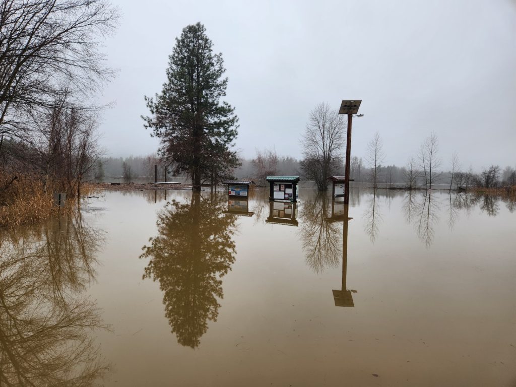
To many people, December’s flooding may have looked like the end of North Idaho’s drought. In reality, the region’s water picture remains fragile—and in some ways, the flood masked deeper problems.
North Idaho has experienced some level of drought since the summer of 2021. While only water year 2024 saw well-below-normal snowpack overall, most recent years have been marked by earlier-than-normal spring runoff and melt-out. That early melt can leave the region dry by mid- to late summer if rainfall doesn’t keep pace.
In mid-December 2025, drought designations across the Idaho Panhandle were temporarily reduced. Above-normal precipitation gave the appearance that drought conditions were easing. However, that improvement was short-lived and largely driven by rain rather than snow.
The December flood itself did little to solve the long-term water deficit. Record warm temperatures and widespread rain across all elevations meant precipitation fell as rain rather than snow. Instead of being stored in the mountains, much of that water ran quickly into rivers and downstream—eventually heading out to the ocean. The warmth also created a denser-than-normal snowpack, which is less able to absorb rainfall and more prone to rapid melt.
Despite all the water on the landscape in December, North Idaho has now slipped back into drought largely because of one missing ingredient: snowpack. Snow plays a critical role in the region’s water supply. Roughly 60 percent of North Idaho’s water comes from snowmelt. Snow acts as a slow-release reservoir, feeding rivers, lakes, and groundwater through spring and summer—when demand is highest.
One way to think about snowpack is as a savings account for seasonal workers. Winter is when you build your savings. Summer is when you live off it. If you don’t put enough away during the winter, it doesn’t matter how much money briefly passed through your hands—you’re still going to struggle later. December’s flooding was like a big paycheck that immediately went out the door, not money set aside for the months ahead.
There are some short-term benefits. Heavy rain increased soil moisture and shallow groundwater, which can improve runoff efficiency during spring melt. But without adequate snow in the mountains, that benefit is limited.
As of now, total precipitation (rain and snow combined) in North Idaho is near to slightly above normal; however, much of that moisture has fallen as rain rather than snow. As a result, snowpack—the region’s primary natural reservoir—remains below normal and has continued a concerning trend of reduced accumulation over recent winters, limiting water storage heading into the warmer months.
Climate trends suggest these rapid swings—from drought to flood and back again—may become more common. Warmer air holds more moisture, increasing the likelihood of extreme precipitation events, rain-on-snow flooding, and longer dry periods between them.
In short, December’s flood didn’t refill North Idaho’s water bank. Despite a wet winter on paper, the region enters the warmer months with below-normal snowpack, reduced natural storage, and below-normal streamflow forecasts.
The Dirt is a series of informative articles focused on all aspects of cleanup efforts associated with the Bunker Hill Superfund Site. Our goal is to promote community awareness of contamination issues, to provide tools for protecting public health, and to keep the community informed of current and future cleanup projects. The Dirt is a group of committed and local experts from multiple agencies including the Basin Environmental Improvement Project Commission, Panhandle Health District, Shoshone County, Silver Valley Economic Development Corporation, and the Idaho Department of Environmental Quality.
THE DIRT: Dayrock Mitigation
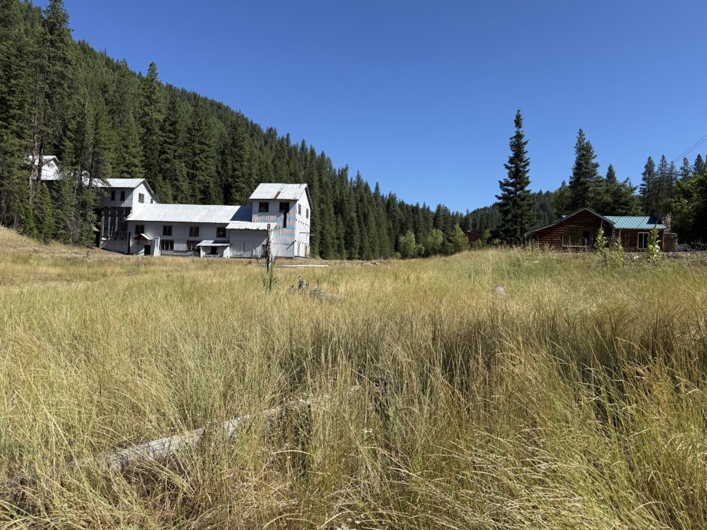
The Dayrock Complex is located near Wallace within Ninemile Creek Basin watershed and is included in the Upper Basin of the Bunker Hill Mining and Metallurgical Superfund site. This site offers a real-world example of how the National Historic Preservation Act (NHPA) guides decisions and mitigation when cleanup efforts affect historic resources. During the Historic Resource Survey, 18 historic-period architectural resources and one archaeological resource were identified leading to the determination that it is a historic district. The Dayrock Complex was determined eligible for listing in the National Register of Historic Places as a significant representation of historic mining technology.
The cleanup at the Dayrock Complex required removing several old buildings and structures that were part of its historic mining district. The work also included adding new modern features—like reconstructed creek channels and culverts which would change the area’s historic layout, setting, and materials. Because these changes affected nearly all the elements that made the Dayrock Complex historically significant, they were considered an adverse effect under the NHPA and Environmental Protection Agency (EPA) determined that mitigation was necessary, and the Idaho State Historic Preservation Officer (SHPO) concurred.
Once mitigation is determined, EPA may reach out to potentially interested parties to discuss the project, its impacts, and begin discussing options to offset the impacts of the cleanup. Since the historic resource being adversely affected is a local resource, the local community should have a voice in what comes from the mitigation process.
To address the Dayrock Complex’s adverse effects, EPA met with Idaho SHPO and several local groups—including the Wallace Planning and Zoning Department, Nine Mile Cemetery Association, Wallace Mining Museum, Wallace Chamber of Commerce, Shoshone County, and the Advisory Council on Historic Preservation—to discuss the project and gather ideas for mitigation. Based on this input, EPA agreed to turn an existing Idaho mining history study into a Multiple Property Documentation (MPD) form, which provides a common framework for evaluating similar mining sites. This MPD provides contexts for the identification, evaluation, registration, and treatment of metal ore mining properties in the geographic area of the state of Idaho during the period 1860–1977. It provides a comprehensive historical overview of mining activities and related technology. The MPD is intended to assist cultural resources professionals, landowners, land managers, and the public in identifying and evaluating mining-related properties based on eligibility criteria for listing in the National Register of Historic Places (NRHP). As part of this effort, EPA also nominated two historic properties—the Nine Mile Cemetery and the Shoshone County Poor Farm—for listing in the NRHP, helping recognize and preserve important mining-related heritage while making future listings easier and more consistent.
Selecting off-site mitigation properties, such as the Nine Mile Cemetery and the Shoshone County Poor Farm, for listing on the National Register of Historic Places offers several key benefits. Listing formally recognizes the historical, architectural, or cultural significance of these properties, providing a clear framework for preservation and ensuring their value is considered in planning decisions. It can also make the properties eligible for preservation incentives such as grants or tax credits, supporting long-term maintenance and protection. Additionally, National Register status strengthens the credibility and transparency of mitigation efforts, demonstrating a commitment to safeguarding heritage resources while achieving environmental or development goals.
By integrating NHPA requirements into Superfund cleanups, agencies ensure that environmental remediation does not come at the cost of cultural heritage. Through careful planning, consultation, and thoughtful mitigation, it is possible to protect human health, the environment, and the stories embedded in historic landscapes.
The Dirt is a series of informative articles focused on all aspects of cleanup efforts associated with the Bunker Hill Superfund Site. Our goal is to promote community awareness of contamination issues, to provide tools for protecting public health, and to keep the community informed of current and future cleanup projects. The Dirt is a group of committed and local experts from multiple agencies including the Basin Environmental Improvement Project Commission, Panhandle Health District, Shoshone County, Silver Valley Economic Development Corporation, and the Idaho Department of Environmental Quality.
THE DIRT: The National Historic Preservation Act
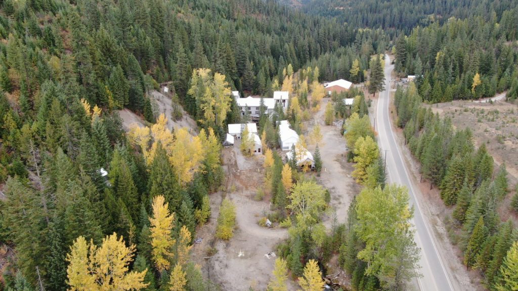
The Silver Valley has a rich history dominated by silver, lead, and zinc mining, which began in the late 1870s and established the region as the world’s largest silver producer by the early 1900s. Visitors come to explore this past, touring local museums to learn about mining practices as well as visit old mining structures that are peppered throughout the region. People are drawn to history because it not only reveals where we’ve been but also helps us better understand the world we live in today.
As a nation, we collectively value historic places, a belief that led to the enactment of the National Historic Preservation Act (NHPA) in 1966. Created to ensure that future generations can appreciate and enjoy the country’s rich heritage, the NHPA established a framework for recognizing historic places at risk of being lost or altered. It provides a systematic process for identifying, evaluating, and protecting historic resources, and it requires federal agencies to consider how their actions may affect historic properties, helping safeguard the nation’s cultural legacy.
To ensure that cleanup efforts do not unintentionally damage irreplaceable historic resources, federal agencies must comply with Section 106 of the NHPA. The U.S. Environmental Protection Agency (EPA) takes into account the effects on historical properties and allows the Advisory Council on Historic Preservation (ACHP) to comment on the work planned. EPA is responsible for identifying any historic properties that may be affected, assess the potential impacts, and consider ways to avoid, minimize, or mitigate any adverse effects. They also consult with the State Historic Preservation Officer (SHPO) and/or Tribal Historic Preservation Officer (THPO) to understand the characteristics of the property that make it historic. Early and ongoing consultation is a cornerstone of the Section 106 process and can uncover information about historic properties or archaeological features that might not be documented elsewhere. This process ensures that environmental remediation and historic preservation move forward together.
Once it is determined a project may affect a historic property, a Historic Property Management Plan (HPMP) may need to be developed. HPMPs were developed for the Upper and Lower Basins of the Bunker Hill Superfund Site to outline the process that EPA will implement to achieve the substantive requirements of the NHPA for ongoing and future cleanup efforts. The HPMPs provide information related to the environmental and cultural context of the area, known and anticipated conditions, and overviews of actions and potential effects that may occur during cleanup activities. The HPMPs also provide project-specific procedures, such as pre-construction cultural resource surveys, that should be completed prior to initiating cleanup work.
As EPA determines how they plan to remediate each site, they work with SHPO, THPO, and other consulting parties to apply the “avoid, minimize, or mitigate” framework required under Section 106. Because much of the cleanup in the Silver Valley requires full removal within the watershed, EPA continues to coordinate with the ACHP, SHPO, and THPO. If adverse effects to historic properties cannot be avoided or minimized, mitigation is required and a mitigation plan must be developed. In which case, impacts are addressed by collecting important archaeological information, creating records and photos of the site, sharing its story through signs or displays, or protecting similar historic places elsewhere.
The Dirt is a series of informative articles focused on all aspects of cleanup efforts associated with the Bunker Hill Superfund Site. Our goal is to promote community awareness of contamination issues, to provide tools for protecting public health, and to keep the community informed of current and future cleanup projects. The Dirt is a group of committed and local experts from multiple agencies including the Basin Environmental Improvement Project Commission, Panhandle Health District, Shoshone County, Silver Valley Economic Development Corporation, and the Idaho Department of Environmental Quality.
THE DIRT: Prichard Creek Restoration
Written by guest author: Cathy Gidley, North Idaho Program Manager for Trout Unlimited
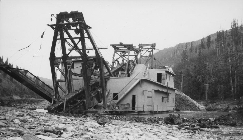
In 1879, AJ Prichard discovered gold in Prichard Creek, setting off the mining rush in the Coeur d’Alene basin. Prichard Creek is a tributary to the North Fork Coeur d’Alene River and was the site of several hard rock mines and mill sites in the 1900s. Placer and lode mining dominated the early mining efforts until a large dredge was brought in from Alaska by the Yukon Gold Company in 1917, operating until 1926. The massive dredge was 106 feet long, 44 feet wide, and 6 stories tall. It worked 24 hours a day, manned by a crew of 12. Reports indicate that it dug down in excess of 20 feet into the river bed. The dredge turned over about five miles of the creek and floodplain, leaving behind a barren landscape of tailings. The disturbance altered the stream channel, causing water to flow subsurface and impairing the habitat and river function throughout the entire length of Prichard Creek to the confluence. Today, an approximately 3 mile section of the creek near the town of Murray loses water for a portion of every year. Westslope cutthroat trout and other native fish species persist in Prichard Creek, but lack the connection to the headwaters upstream.
The Idaho Forest Group, who owns 10.5 miles adjacent to the stream channel, became interested in restoring the degraded stream and entered into a partnership with Trout Unlimited, with funding and support from the Restoration Partnership, sponsored by Idaho Department Environmental Quality. Though the partnership between a timber company and conservation group was unusual, it has proved to be extremely successful. After years of planning, work was completed in 2023 to improve habitat and river function in the lower 4 miles of the creek. A total of 62 log structures with various objectives were constructed, and over 5,000 willow stakes and 3,000 riparian and upland plants were planted. After 2 years the structures are showing success in creating pools, dividing flow to move water into side channels, trapping sediments, and creating islands of vegetation. The new structures have attracted the attention of beavers and they have moved back into the main channel in some areas, having been largely absent- the valley bottom was likely historically inundated and teeming with life. The IFG property was placed into a conservation easement with the Kaniksu Land Trust, ensuring that the improvements are sustained into the future.
Building on the success of the initial project, a design process is currently underway to work on the next phase which will address the dredged area and dewatered section of the creek downstream of Murray. It will likely be several years before the project is implemented. Project partners will host meetings to keep the public informed regarding the next phase. AJ Prichard is buried in the cemetery near Murray, his legacy evident throughout the valley. Through partnerships, our hope is to honor that legacy and restore the rich environment that attracted Prichard and countless others to this region.
For additional information on projects: northidahotu.org Cathy Gidley, North Idaho Program Manager cathy.gidley@tu.org
The Dirt is a series of informative articles focused on all aspects of cleanup efforts associated with the Bunker Hill Superfund Site. Our goal is to promote community awareness of contamination issues, to provide tools for protecting public health, and to keep the community informed of current and future cleanup projects. The Dirt is a group of committed and local experts from multiple agencies including the Basin Environmental Improvement Project Commission, Panhandle Health District, Shoshone County, Silver Valley Economic Development Corporation, and the Idaho Department of Environmental Quality.
THE DIRT: How Flooding in the Bunker Hill Superfund Site is Different

While flooding in North Idaho is not uncommon, high flow events like the one that occurred in December 2025 can have consequences that extend beyond immediate water damage. When high flows sweep through the Coeur d’Alene River Basin, they interact with a landscape shaped by more than a century of mining activity. Historic discharges mean that floodwaters have the potential to move metals and other pollutants downstream, affecting both the environment and the communities that live along these waterways.
Flood damage usually brings to mind washed-out roads, detours, and debris—but when floods hit contaminated waterways like those in the Coeur d’Alene River Basin, the risks go far beyond the obvious. From 1884 until 1968, Silver Valley mines directly discharged millions of tons of metals contaminated mine waste into the South Fork of the Coeur d’Alene River and its tributaries. These wastes traveled downstream into the main channel of the Coeur d’Alene River and chain lakes of the Lower Basin, leaving a devastated landscape behind. The waters of the South Fork and main stem of the Coeur d’Alene River ran milky gray, the vegetation lining the banks died off, and wildlife abandoned the area. The magnitude and duration of historic practices left a vast legacy of contaminated sediment throughout the river corridor and its connected aquatic and floodplain habitats.
The increased volume and speed of water traveling downstream during flood events can greatly disturb these historic sediments, dislodging them from the riverbed and banks, carrying them downstream and into the nearby low-lying lands. As weather conditions improve, floodwaters begin to recede, and the process of deposition begins. Deposition is a normal process that occurs as floodwaters lose their velocity and begin to subside. The sediments begin to settle out and remain on the surface of the land after the waters return to normal levels in the river. When this occurs within contaminated areas, contaminated sediments can be left behind.
As the years passed with no direct discharges of mine waste to the river and remediation began throughout the Coeur d’Alene River Basin, the land showed signs of recovery. The waters of the Coeur d’Alene River no longer ran milky gray with mine waste, the floodplain became revegetated, and wildlife began returning to the area. River and lake front properties in the Lower Basin no longer looked polluted and people began to view the land as prime recreational real estate. Unfortunately, these properties are still contaminated, and continue to pose a risk to human health, wildlife, and the environment.
When properties along the river and portions of the chain lakes are developed for recreational or residential use, owners are required under Panhandle Health District’s Institutional Controls Program to install clean barriers anywhere contaminated land is being developed, actively used, and/or maintained. Clean surfaces such as gravel, topsoil, asphalt, or concrete, when installed properly, help protect those using the land from exposure to metals such as lead, arsenic, and cadmium, and these clean barriers have been proven to reduce exposure to these metals. However, when floodwaters inundate remediated areas, barriers can be compromised in several ways: gravel may erode or become mixed with contaminated sediments, concrete or asphalt can crack or heave, and vegetated or “greened” areas can be buried under a thin layer of contaminated silt that is not always visible at the surface. Over time, these conditions can reduce the effectiveness of the barrier. It is the property owner’s responsibility to protect and maintain their barriers, which can be a costly expense.
Flooding can undo years of remediation, leaving contaminated sediments on properties and compromising protective barriers. Property owners along the Coeur d’Alene River and chain lakes should inspect and maintain clean surfaces after every flood and contact the Panhandle Health District (PHD) for guidance to keep their land safe from lead, arsenic, and cadmium exposure.
The Dirt is a series of informative articles focused on all aspects of cleanup efforts associated with the Bunker Hill Superfund Site. Our goal is to promote community awareness of contamination issues, to provide tools for protecting public health, and to keep the community informed of current and future cleanup projects. The Dirt is a group of committed and local experts from multiple agencies including the Basin Environmental Improvement Project Commission, Panhandle Health District, Shoshone County, Silver Valley Economic Development Corporation, and the Idaho Department of Environmental Quality.
THE DIRT: December Flooding on the Coeur d’Alene River: An Unusual Early-Season Event
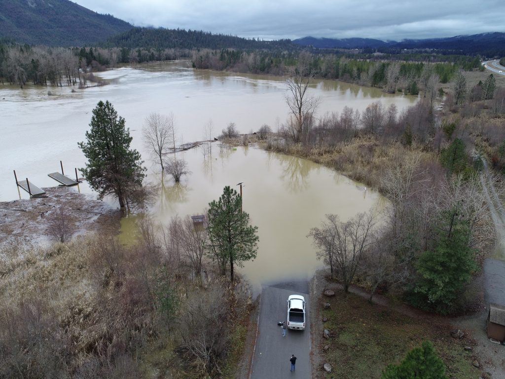
The flood event that struck the Coeur d’Alene River Basin around December 11, 2025, was unusual—not because flooding itself is rare in North Idaho, but because of when and how it occurred.
December 2025 brought historically high air temperatures and was the second wettest December on record across most SNOTEL sites in the Basin. A SNOTEL site is an automated remote station that measures snowpack, precipitation, and temperature to track water supply conditions, especially in mountain watersheds. While rain-on-snow events are fairly common in the Coeur d’Alene River watershed, this one stood out due to its sheer magnitude and geographic reach. Rain fell across nearly all elevation bands, including the highest elevations that typically remain cold enough to store snow well into winter. Under normal conditions, rain at lower elevations might trigger some snowmelt, but this event caused widespread melt across the Basin.
In terms of historical context, the December 2025 flood ranked 28th in daily median stream volume for the Coeur d’Alene River. While it did not surpass the largest floods on record—such as the historic January 1974 flood or the February 1996 event—it was notable for occurring much earlier than typical high-flow events. The largest floods in the Basin have historically taken place in January or February, with most high flows occurring during the April–May runoff season. December floods exceeding median streamflow are relatively rare, making this event an outlier.
Several factors combined to rapidly push water into rivers and streams. Warmer-than-normal conditions in November, followed by a record-warm December, produced an unusually dense snowpack across the Basin. Dense, warm snow is less capable of absorbing rain than colder, lighter snow. Near-normal precipitation in October and early December rain at lower elevations also left soils saturated. When soil is already wet, it cannot absorb much additional water, effectively fast-tracking runoff directly into creeks, rivers, and lakes. Together, above-normal temperatures, dense snowpack, and saturated soils created what hydrologists describe as a “perfect storm” for flooding.
Tributaries played a role as well. While limited snowpack monitoring exists in the headwaters of Prichard Creek and Beaver Creek, it is reasonable to assume they experienced similar melt conditions. The North Fork of the Coeur d’Alene River near Prichard reached record-high flows for the month of December, underscoring how widespread the event was.
Looking ahead, climate trends suggest December-season flooding could become more common. Although overall snowpack in the western United States is declining, warmer temperatures mean that the snow that does accumulate is often denser and more prone to rapid melt during rain events. Many studies indicate an increasing likelihood of rain-on-snow events—conditions that elevate flood risk even outside the traditional runoff season.
The Dirt is a series of informative articles focused on all aspects of cleanup efforts associated with the Bunker Hill Superfund Site. Our goal is to promote community awareness of contamination issues, to provide tools for protecting public health, and to keep the community informed of current and future cleanup projects. The Dirt is a group of committed and local experts from multiple agencies including the Basin Environmental Improvement Project Commission, Panhandle Health District, Shoshone County, Silver Valley Economic Development Corporation, and the Idaho Department of Environmental Quality.
THE DIRT: Historic pollution study of the Coeur d’Alene Basin Pt.4
By the early 1930s, much of the Coeur d’Alene River was effectively lifeless. Fish had disappeared, plankton was dying, and long stretches of the river showed little sign of recovery. In 1933, federal scientists confirmed that mine-contaminated water was deadly to aquatic life—but their most alarming discovery came when they looked beyond the water itself, to what remained behind.
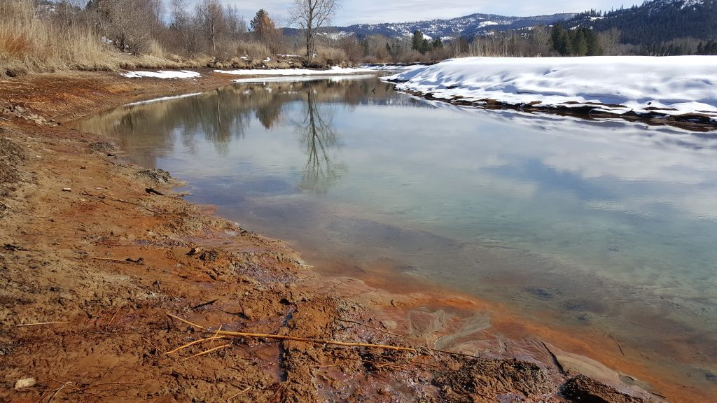
The greatest danger lay in the hard mineral build up that formed on mine wastes exposed to moisture, light, heat, and oxidation. Samples collected from Smelterville Flats and Thompson Flats were chemically distinct from other waste materials and quickly identified as highly toxic.
Goldfish were used extensively in these experiments due to their resilience, despite not being native to the watershed. Even very small amounts (0.01%) of the Thompson Flats material caused fish to release large amounts of slime. At higher concentrations (0.18%), fish became weak, lost control of their movements, and could no longer swallow. Prolonged exposure resulted in black lead deposits forming in the fins, followed by death.
In lower-concentration tests where the material was allowed to settle, mucous production subsided and fish often recovered within days. This pattern revealed a critical mechanism: when disturbed or suspended—such as during floods—the material became deadly.
Further testing across multiple species showed that zinc caused fast, immediate harm, while lead caused damage that built up over time. Even when polluted water was heavily diluted—just one part contamination mixed into 100,000 parts clean water—it stopped digestion in fish, frogs, and turtles, permanently altered heart function, and killed all plankton within 24 hours. Comparative studies showed incrustations from Smelterville Flats to be even more toxic than those from Thompson Flats.
Based on this evidence, Ellis concluded that mine wastes discharged into the South Fork in the Wallace–Kellogg area had rendered more than 50 miles of the South Fork and main Coeur d’Alene River effectively barren—devoid of fish, plankton, and aquatic food sources. He warned that massive deposits of toxic materials along riverbanks and floodplains would continue to poison the river and threaten downstream waters, including Lake Coeur d’Alene itself. Even if discharges ceased, recovery would take time.
Ellis did not call for an end to mining. Instead, he concluded that the only way to prevent pollution-related harm to fisheries was to keep all mine waste out of the Coeur d’Alene River. He pointed to successful waste-management systems in Kimberly, British Columbia, where tailings were routed to settling basins before treated water was released. Similar systems were being tested at the Bunker Hill and Page Mines but were not widely adopted. The Mine Owners Association instead installed a suction dredge at Mission Flats—an approach Ellis acknowledged would reduce, but not eliminate, pollution.
Direct discharge of mine waste into the river finally ended in 1968 with federally mandated water quality regulations and widespread use of settling ponds. Despite these improvements, historic mining left a lasting legacy. Tailings still line riverbanks and floodplains, forming layers several feet deep that resemble sandy beaches but contain contaminated sediments.
Today, elevated blood lead levels in children and ongoing waterfowl mortality continue to be linked to these deposits. Remediation remains complex, particularly in flood-prone areas where recontamination is possible. Nevertheless, progress continues. Recent efforts include remediation of approximately 700 acres at Gray’s Meadow near Black Lake, converting contaminated land into managed functional wetlands. Upcoming projects include pilot river treatments along the Dudley Reach and restoration of the Gleason wetlands.
Until cleanup is complete, residents and visitors are urged to exercise caution when recreating in affected areas. More information about ongoing remediation and public safety is available at cdabasin.idaho.gov.
THE DIRT: Historic pollution study of the Coeur d’Alene Basin Part 3
During the summer of 1933, Dr. Ellis and a team of scientists from the U.S. Bureau of Fisheries launched one of the first systematic investigations into the effects of mine waste on the Coeur d’Alene River system. Their work sought to understand how decades of mining activity had altered the watershed’s chemistry and biology.
The study began with a review of historic and contemporary mining and milling practices, followed by an inventory of aquatic species and a chemical analysis of mine wastewaters. From there, the team conducted laboratory and field experiments to determine how native aquatic organisms responded to contaminated water.
To assess real-world conditions, live dace minnows and long-nosed dace were placed in large wooden live-boxes. One box was stationed offshore of Harrison Beach in Lake Coeur d’Alene, where relatively clean lake water mixed with river water. A second was placed a quarter mile upstream in the Coeur d’Alene River, fully saturated with mine waste. After three days, the results were stark: fish in the lake remained alive and healthy, while all fish in the river box had died, their bodies coated in heavy mucous slime.
The researchers next examined plankton, microscopic crustaceans that form the base of aquatic food webs. Water samples were collected from four locations: the river mouth at Harrison, a quarter mile upstream from Harrison, the river at Dudley, and clean water from Canyon Creek above the mining district. Each sample was settled and maintained at the same temperature in the laboratory, with tap water used as a control.
Plankton exposed to water from a quarter mile upstream died within 18 hours; those in Dudley water survived no more than 36 hours. Approximately 80 percent of plankton in mixed water from the river mouth died within 48 to 72 hours. No deaths occurred in the clean Canyon Creek or tap water samples during the 14-day experiment.
These findings confirmed what fishermen and riverside communities had long suspected: polluted reaches of the Coeur d’Alene River were acutely toxic, capable of wiping out both fish and the microscopic life that sustained the entire aquatic food web.
To pinpoint the cause, Ellis and his team isolated individual components of the waste stream and tested their effects on frogs, turtles, catfish, bass, goldfish, and plankton. Materials examined included milling chemicals, isolated lead and zinc ores, and hard mineral build up that formed on mine tailings exposed along riverbanks and floodplains.
Milling chemicals showed variable toxicity, with the strongest effects occurring near mill discharge points. As these chemicals traveled downstream, dilution from cleaner tributaries reduced their potency. While dangerous near their source, the scientists concluded that milling chemicals alone could not explain the widespread biological collapse observed miles downstream.
Testing of isolated ores revealed clearer patterns. Plankton exposed to lead ore died within 48 hours, while fish survived longer but secreted heavy mucous until lead particles settled out of suspension. Zinc ore, by contrast, produced no deaths and no visible distress.
Yet these results only deepened the mystery. If milling chemicals weakened with distance and raw ores failed to explain the river-wide devastation, what was causing such severe and persistent toxicity throughout the watershed?
That question led Ellis and his team to focus on a far more dangerous culprit—one formed not in mills or tunnels, but along the riverbanks themselves. Stayed tuned for the final installment of the Ellis Report findings.
THE DIRT: Part II of Historic Pollution Study of the Coeur d’Alene River Basin
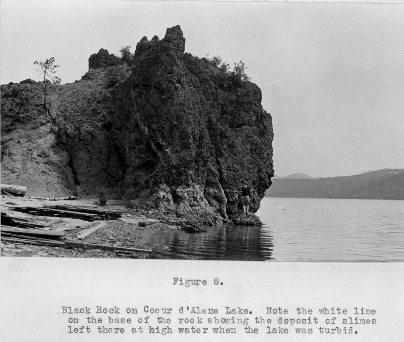
After mounting local and political pressure, the Idaho state legislature authorized a study of the pollution problems created by Silver Valley mines directly discharging waste into area waterbodies. The Coeur d’Alene River and Lake Commission was created to direct the study, and the commission requested the assistance of the United States Bureau of Fisheries who authorized a survey and a team of four fisheries scientists to investigate the issue. The study was to be conducted during the summer months of 1932, with results reported back to the Idaho State Legislature in 1933. Commissioner Cathcart, as the acting Secretary of the Coeur d’Alene River and Lake Commission, began preparing for the Bureau’s research team in the spring of 1932. Cathcart had a fully functional field laboratory constructed inside a boat house in Harrison; he also secured a small boat and vehicle for the team’s day trips and hired a local man familiar with area waterways to guide them. The team, led by Dr. M.M. Ellis, arrived in Harrison on July 9th, and started work the next day.
Ellis and his crew began by surveying the river system and learning about the disposal practices of the mines. He learned that for the first forty years of operation the mills in the district used the jig table method to process their ores. This method was quite inefficient and considerable quantities of lead and zinc ore were lost with these tailings as they were dumped in the river. The jig method produced larger rock particles and a finer rock powder. Due to their larger size and heavier weight, the jig tailings did not travel as far and completely settled out by the time they reached the Mission Flats in Cataldo where the river widened slightly and created a natural sedimentation area. Ellis noted that the entire Mission Flats area, consisting of several thousand acres, was now entirely covered with mining tailings and slimes that had settled out there. He interviewed several steamboat captains in the area who told him 15 to 20 years ago they could drive their steamboats and tugboats to the Old Mission, but the channel and the mainstream became so obstructed by large bars of mine waste and tailings that this could no longer be done. Inundated with so much waste, the river continued to carry enormous amounts of finer tailings into the Lower Basin miles downstream and into Lake Coeur d’Alene.
By the early 1920s all the mills in the district had converted to a much more efficient selective floatation method. While metal recovery rates improved, the floatation method created new issues. First, the ore bearing rock was reduced in ball mills to a tailings powder much finer than the powder formerly created from the jig tables. When mixed with water these tailings became slimy in texture and were called mine slimes by locals. Because of their small particle size, these new tailings did not readily settle out and were carried farther by the river and were also more susceptible to chemical changes. The floatation method also allowed for ore of much lower grade to be profitably handled, which increased mining efforts and thus increased the amount of waste in general. Lastly, the floatation process required the use of chemicals for separation and float substances that promoted bubbling and frothing, all of which presented new pollution problems.
Next, the science team began taking inventory of living organisms throughout the watershed, including the mine impacted sections of the river, Coeur d’Alene Lake, and the nearby Chain Lakes. They also assessed streams and waterbodies within the basin which were not impacted by mining activities. They collected data on fish fauna, bottom species, plant life, and the microscopic phytoplankton and zooplankton which are necessary to sustain fish populations. The primary focus was to assess numbers and types of fauna present in the contaminated waters and compare those to nearby streams and lakes not impacted by the mine waste. No fish or plankton were found in the portions of the river actively carrying mine waste and it was practically devoid of all aquatic animal life. In contrast the nearby unimpacted side streams and sections above the mining district were found to be thriving with aquatic life. In areas where the mine waters mixed with clean water sources, such as the chain lakes of the Lower Basin, species counts also dropped considerably, with no life in the heavily mixed areas, and increasing life as the water became more diluted. It was clear that these waste materials were taking a toll on the Coeur d’Alene River ecosystem, so now the scientist attempted to find out why.
The sheer number of tailings moving through the river system was enough to be deadly to aquatic species, but the chemical make-up of these sediments also played a significant role. The ore deposits in the Coeur d’Alene district are primarily sulfides but when exposed to air, sunlight, and moisture these metals begin changing chemically into sulphates and oxides, making them even more toxic. Area farmers explained that the tailings deposited on their farms and left along the shores of the river after high water events produced toxic, crystalline substances that killed crops and stock, particularly horses, and to some extent cattle, dogs, and chickens. In addition to studying the tailings themselves, chemical analyses of other conditions that impact fish life were completed including measuring dissolved gases, pH levels, and specific conductance of the mine impacted waters versus non-impacted waters. It was determined that mine waste had not greatly disturbed the balance of dissolved gases, relative acidity, or specific conductance, so the absence of aquatic life could not be ascribed to these conditions but rather to the contents of the waste itself.
Check back for Part 3 to see what the scientist found.